By playing, you allow YouTube (Google) to process data and use cookies. Privacy.
Tracking groups with drones
Reconstructing individual trajectories and environmental context with computer vision.
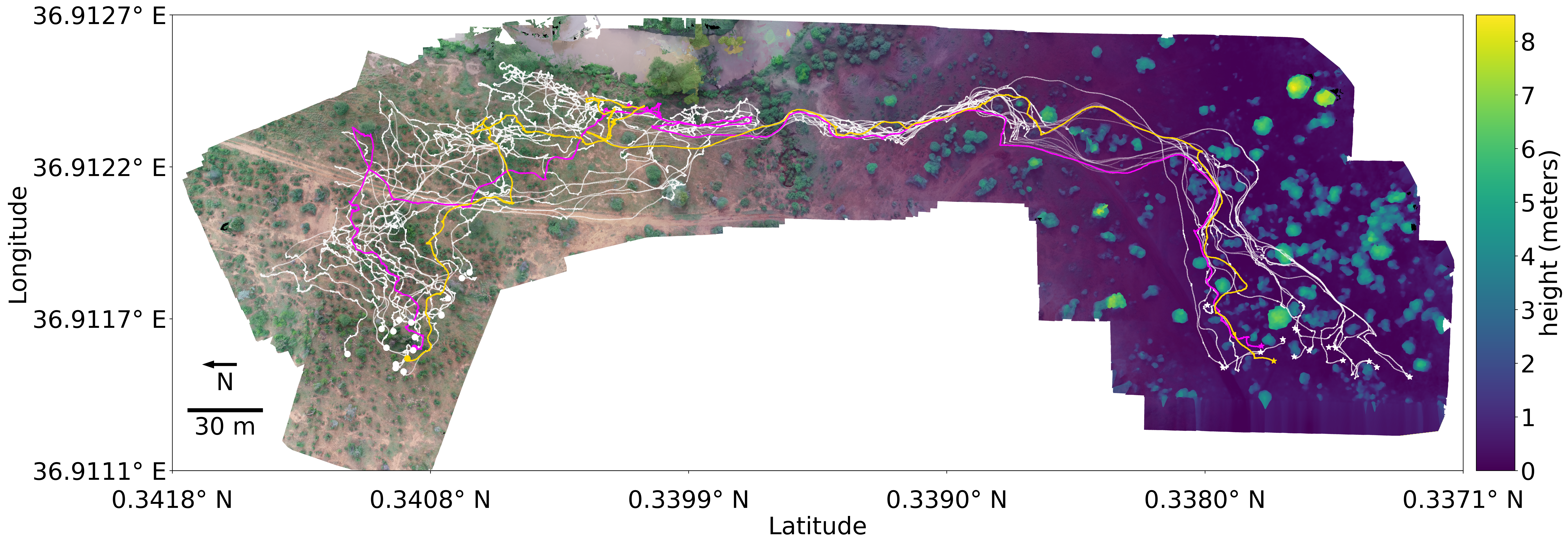
This work introduced a drone- and computer vision–based system for high-resolution tracking of animal groups in the wild.
 Enlarge figure
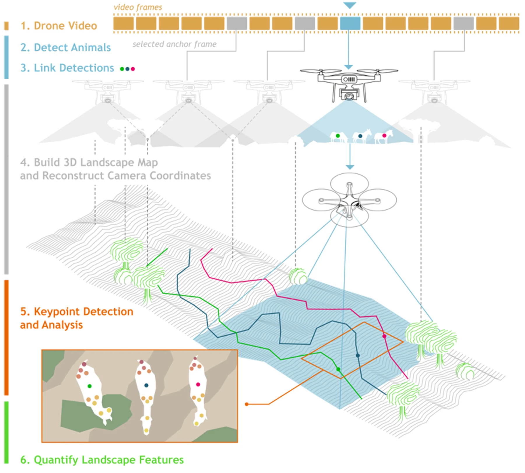
From aerial video to movement in the landscape
Animal tracks and a reconstructed 3D landscape are combined to place movement in geographical coordinates. This separates the animals’ motion from the drone’s motion.
Figure 1 · Koger et al., Journal of Animal Ecology (2023) · CC BY-NC. Cropped from the published figure.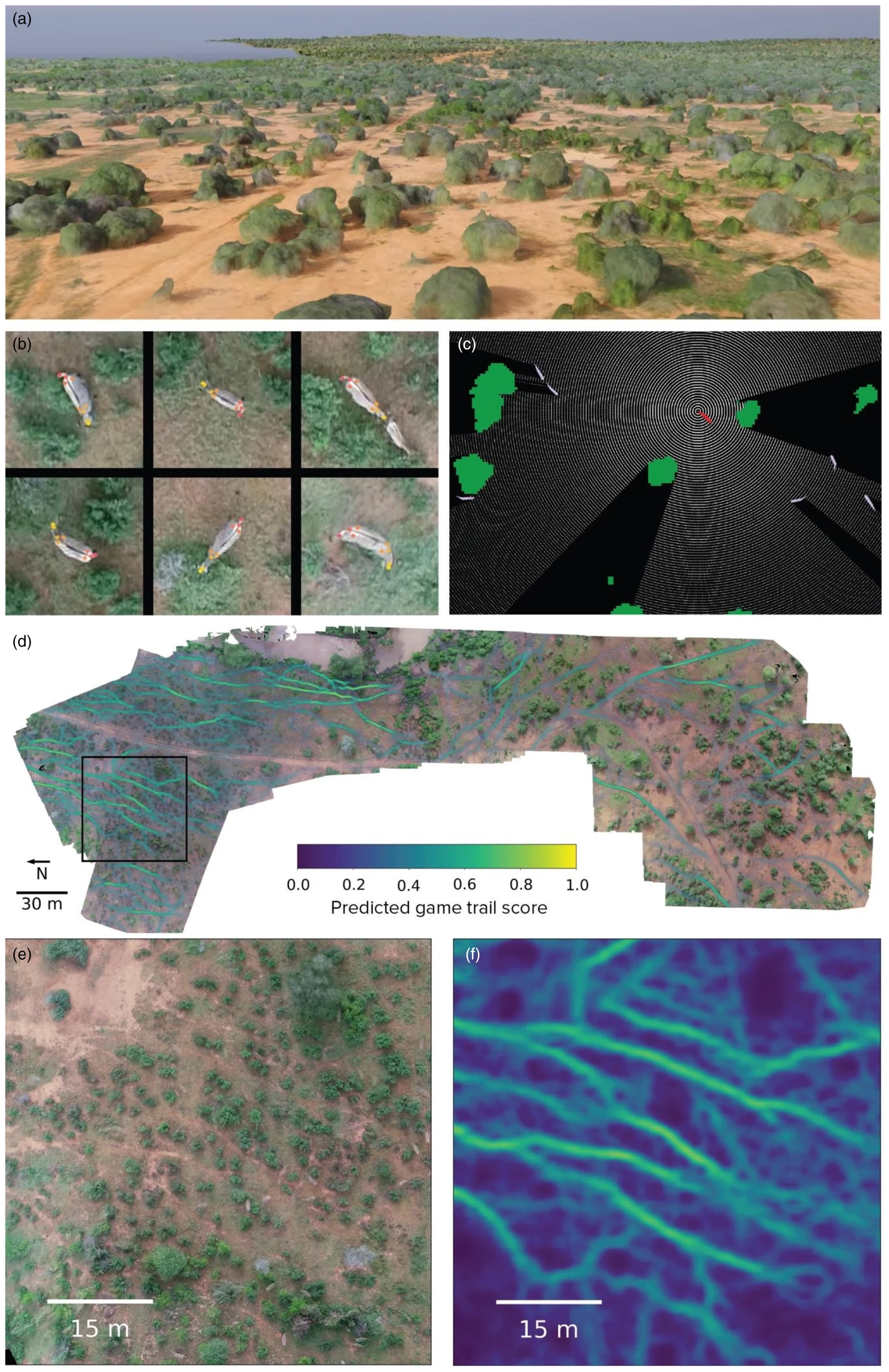
My contribution
I helped build and refine a scalable pipeline that combines drone video with deep learning and computer vision algorithms to detect, track, and reconstruct 3D movement and environmental context for wild animals. Working with an interdisciplinary team, we enabled large-scale, non-invasive behavioral analysis in natural settings — advancing tools for behavioral ecology and conservation.